The Fort Portal crater lakes are a field of volcanic crater lakes in western Uganda, on the high ground south of Fort Portal town between the eastern edge of Kibale Forest and the foothills of the Rwenzori Mountains. You drive them on loops of unsealed murram road, either as a half day out of Fort Portal or as the slower, better-looking way to travel between Kibale and Queen Elizabeth National Park.
They are not a park, they are not gated, and there is no single signposted route. That is the whole planning problem, and it is what this article is about.
Where exactly are the crater lakes?
The lakes sit in the belt of country between Fort Portal town, the eastern edge of Kibale Forest and the foothills of the Rwenzori Mountains, reached by turning off the main road south of town onto murram. A second, separate run of craters lies much further south, on the descent into Queen Elizabeth National Park. The two get bundled into the same conversation even though they are a different day's driving.
How many lakes there are depends entirely on what you count as one. Estimates circulate widely and none of them come from a mapping authority, so we do not quote a number. What matters practically is that they sit close together, so you can see a lot of them in a short stretch of road.
Most of the lakes lie outside any national park boundary, on community and private land. Access is therefore a matter of local arrangement rather than a published tariff: some viewpoints are free to stop at, some sit on lodge land, some have a community guide who expects a fee. Those amounts vary by lake and are not set by any authority, so we confirm them at quote stage rather than publishing a figure that would be wrong somewhere.
Is there one crater lakes drive, or several?
Several, and choosing between them is the real decision. In practice there are three shapes:
- The classic loop. A circuit on murram roads off the main road south of Fort Portal, taking in a run of viewpoints, ridges with water on both sides, and villages and tea smallholdings in between. This is what the phrase "crater lakes drive" usually means.
- The Kibale corridor. Not a loop at all, but the ordinary road down to Kibale, with crater detours attached. Sensible if chimpanzee tracking is the reason you are in the region and the lakes are the bonus.
- The long way to Queen Elizabeth. Leaving Fort Portal or Kibale southwards and picking up the second run of craters on the way into the park. This turns a transfer day into a sightseeing day.
Which version should you do?
| Version | Suits | What you get | Watch out for |
|---|
| Half-day loop from Fort Portal | Anyone with one spare morning or afternoon | The densest run of viewpoints, plus villages, tea and crater rims | Needs a driver who knows the junctions; the loop is not signposted |
| Crater detours bolted onto a Kibale day | Trips built around chimpanzee tracking | Scenery without spending a whole extra day on it | Tracking start times are fixed, so the detour has to fit around them |
| Full day, Fort Portal to Queen Elizabeth the scenic way | Travellers who dislike wasted transfer days | Two separate crater fields and the descent onto the rift floor | Long day; arriving at your lodge late costs you an evening game drive |
| Two nights on a crater rim | Slow travellers, honeymooners, photographers | Dawn and dusk light on the water, which is when the craters actually perform | Rim-side beds are limited, so book early rather than late |
What vehicle and what driver do you need?
A high-clearance 4x4 with a driver-guide who has driven these roads before. That is not an upsell, it is the shape of the problem. The crater loops are murram, they are narrow, they climb and drop steeply between rims, and the junctions look alike. Do not count on signage, and do not hand the routing to a mapping app either: a line on a phone map here can turn out to be a footpath, and no app will tell you which turning leads to a viewpoint and which leads into somebody's banana garden.
Two practical consequences. First, a saloon car may reach a viewpoint or two in dry weather and is the wrong tool for the loop after rain. Second, the value of a local driver here is navigational rather than mechanical. If you are weighing driving yourself against being driven, our note on fly-in versus road safaris in Uganda covers the wider trade-off.
When is the best time to drive the crater lakes?
Road surface is the deciding factor, and the regional rainfall record is clear enough to plan against. The long-term field record at Kibale, next door to the crater lakes, shows a bimodal pattern: rainy seasons in March to May and September to November, dry seasons in December to February and June to August, with roughly 1,646 mm of rain a year and monthly temperatures ranging from about 15C to about 29C. The Uganda National Meteorological Authority describes the national picture the same way, naming March-April-May and September-to-December as the two rainfall seasons and December to February as typically dry across Uganda, with February the hottest month.
So the dry windows are the easy driving. Murram holds together and the steep sections between rims stay passable.
That is a comfort argument, not a scenery argument. The craters are greenest at the end of the rains, rain clears the haze that otherwise softens the Rwenzori backdrop, and a wet-season morning after an overnight downpour can be the best light you will get. If you travel in the rains, build slack into the day and accept that a particular loop may be off the table on the morning. For a broader month-by-month view see best time to visit Uganda.
What does a crater lakes day actually cost?
The drive itself is not the expensive part. The cost sits in what you attach to it, and the fixed part of that is set by the Uganda Wildlife Authority.
| Item | Rate (foreign non-resident) | Notes |
|---|
| Kibale park entrance, per adult per 24 hours | USD 40 (children USD 20) | UWA Category A rate. If you are tracking chimpanzees in Kibale, entrance for that day is already inside the permit and must not be added twice; this fee is for a Kibale visit made without a tracking permit |
| Queen Elizabeth park entrance, per adult per 24 hours | USD 40 (children USD 20) | If you continue south. UWA states entrance is independent of package activities, and the Kyambura Gorge chimpanzee permit excludes entrance, so both are payable there |
| Launch cruise, Queen Elizabeth | USD 30 per person | Approximately two hours |
| Shoebill viewing by boat, Toro-Semliki Wildlife Reserve | USD 100 | Covers three people; each additional person USD 20 |
Those are UWA foreign non-resident rates, read from the Conservation Tariff July 2024-June 2026 alongside the Executive Director's circular of 26 February 2026, and checked on 31 August 2026. UWA states its fees are subject to change without prior notice. The booklet's printed validity ran to 30 June 2026 and no successor booklet has been published, so treat these as the rates UWA is currently serving rather than as a formally extended tariff. We confirm the figure that applies to your dates when we quote.
Chimpanzee permits are the biggest single line in any day built around the forest, and they are priced separately from entrance. The Kibale tracking and habituation permits both include the guide fee and park entrance for the day of the activity; there are discounted rates in April, May and November that UWA will not reschedule; and the primate tariff changes again on 1 January 2027. The current figures and the low-season rules are set out in chimpanzee tracking in Kibale.
Two Ugandan booking rules matter more than the prices. Foreign non-residents cannot buy Ugandan chimpanzee or gorilla permits directly: UWA sells them only through operators licensed by the Uganda Tourism Board. And since 1 March 2026 there is no free hold period at all. UWA suspended the seven-day unpaid reservation window, so a permit is secured only on full payment at the time of booking. If a date matters to you, it has to be paid for, not pencilled in.
Lodge rates around the craters we do not publish, because they move and because the range from a simple rim guesthouse to a private lodge is enormous. Those come with your quote.
What else is worth stopping for nearby?
- Kibale Forest for chimpanzees, on chimpanzee tracking. UWA's Kibale park page gives trek departures from Kanyanchu at 08:00, 11:00 and 14:00, so a crater detour has to be built around a fixed start rather than the other way round.
- The Amabere ga Nyina Mwiru caves and their waterfall, close to town: see Amabere ga Nyina Mwiru.
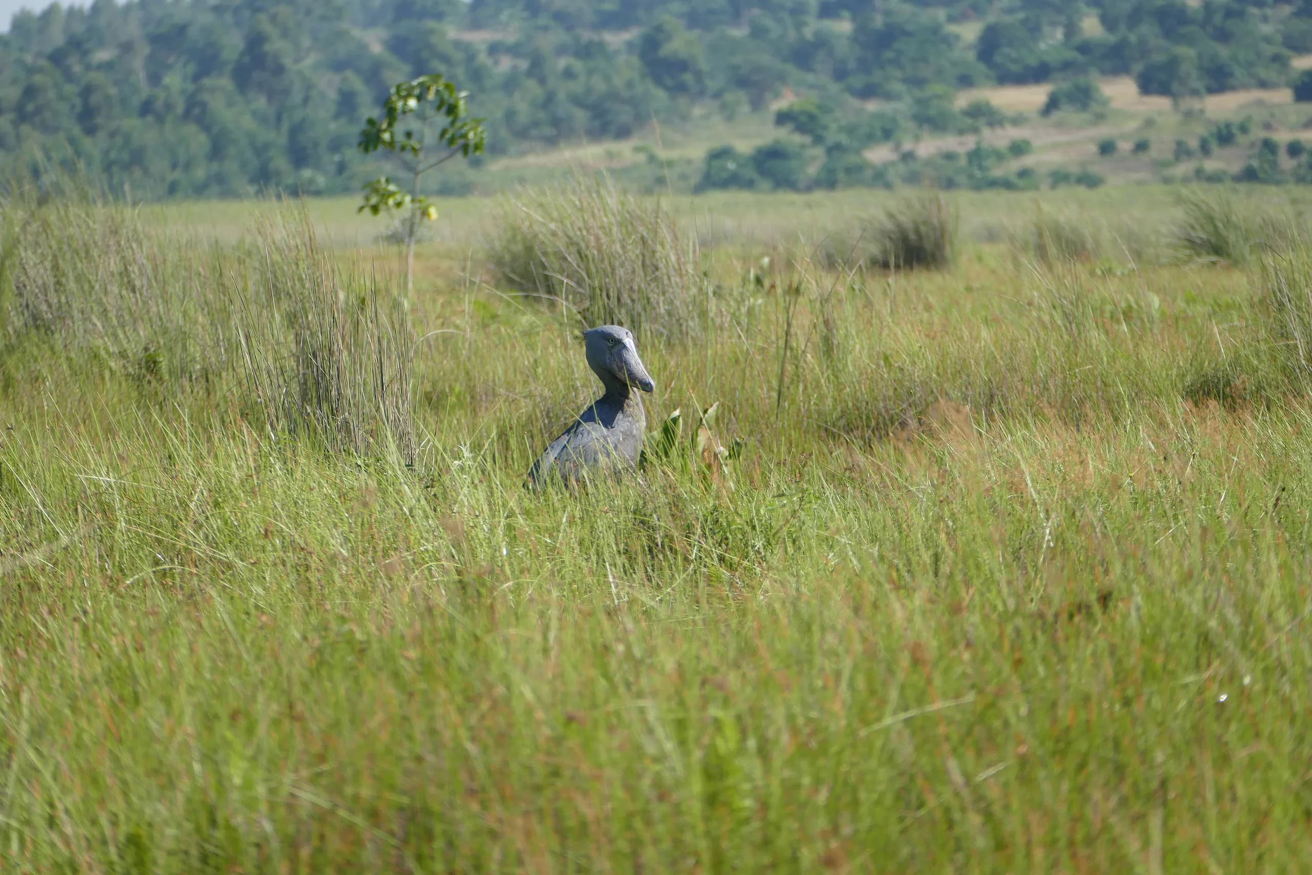
- Toro-Semliki Wildlife Reserve for shoebill by boat. Worth knowing: a UWA gorilla permit includes one day's free entrance to Toro-Semliki and to Mount Elgon, usable within one month either side of your tracking date. It is easy to forget to claim, so ask for it.
- The Rwenzori foothills, which stand behind the craters on a clear morning.
- Tea estates on the road south, which give much of this landscape its manicured look when seen from a crater rim.
Mistakes worth avoiding
- Treating it as a photo stop. One viewpoint on the way past is a disappointment. The craters work as a sequence.
- Driving the loop in the middle of the day. Overhead sun flattens the water and the haze is at its worst. Early morning and late afternoon are not marginally better, they are a different place.
- Stacking it onto a chimpanzee tracking morning without checking timings. Tracking start times are fixed and a trek can run several hours.
- Assuming the road is the road. A route that was fine in July may be a poor idea in April.
- Leaving permits to the last minute. With no unpaid hold available, a date is either paid for or it is not yours.
How the crater lakes fit a wider trip
The natural place for them is as the connective tissue of a western Uganda route: Fort Portal and the craters, Kibale for chimpanzees, then south to Queen Elizabeth and on toward the gorillas. It is the stretch that stops a Uganda itinerary reading as a list of parks. See Uganda primates and savannah for how that sequence runs, or the Fort Portal crater lakes destination page for the region itself.
Drive times, road conditions on your specific dates, and which loops are sensible in the week you travel are things we confirm rather than estimate. Tell us your dates on plan your safari and we will build the day around what is actually passable.