
Uganda, mountain range
Rwenzori Mountains National Park
Glaciers on the equator at 5,109 metres, and a week of bog to reach them
About Rwenzori Mountains National Park
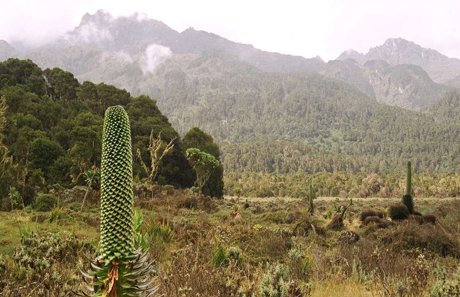
The Rwenzori are not volcanoes. They are a block of very old rock pushed up along the western arm of the rift, which is why the range is a wall rather than a cone, why it traps every weather system coming off the Congo basin, and why it carries permanent ice thirty kilometres from the equator. Margherita Peak on Mount Stanley is 5,109 metres and the third highest mountain in Africa, after Kilimanjaro and Mount Kenya.
These are the Mountains of the Moon that Ptolemy put on a map in the second century as the source of the Nile, and which nobody from outside confirmed until Stanley saw them through a break in the cloud in 1888. The Duke of the Abruzzi brought a full expedition here in 1906, climbed and named the main peaks, and the names he gave them are the ones still on the map.
Getting to the top takes six to nine days depending on the route, and the defining feature is not altitude or ice but water. It rains here on most days in most months. The heather zone is hung with moss, the valley floors are bog, and a Rwenzori trek is mostly a week of wet feet and tussock hopping through some of the strangest vegetation on the planet. People who love it love it more than any other trek in East Africa. People who wanted a dry mountain should climb Kilimanjaro.
Two routes, two operators
There are two ways up and each is run by a single trekking company under agreement with the Uganda Wildlife Authority. The Central Circuit starts at Nyakalengija, 22 kilometres north of Kasese, is run by Rwenzori Mountaineering Services, takes about seven days and is the historic route through the Bujuku and Mubuku valleys. The Kilembe Trail starts at Kilembe, 12 kilometres west of Kasese, is run by Rwenzori Trekking Services, takes eight to nine days to Margherita and passes more of the high lakes; its huts are newer and generally better. Both reach the summit and both are legitimate. Pick on hut standard, on itinerary length and on which company answers your emails properly.
The zones, and the bog
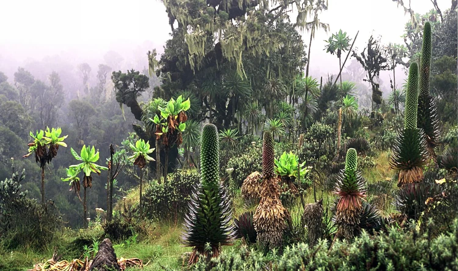
You climb through montane forest, then bamboo, then the heather zone where tree heathers grow to six metres and everything is draped in old man’s beard, then the Afro-alpine zone of giant groundsel and giant lobelia standing above the tussock grass, then rock and ice. Nothing else in Africa looks like the middle of that sequence.
The bog is the part every returning trekker talks about. Bigo Bog and the upper Bujuku valley are crossed by stepping from tussock to tussock, and a missed step puts you in to the knee or further. Boardwalk has been laid on some sections and it is not continuous. Gaiters are not optional, two pairs of boots is a reasonable idea, and nothing you own will be dry after day two.
Summit day, and the shorter alternatives
Margherita is a mountaineering objective rather than a walk. Summit day starts around 02:00 from the highest camp, involves fixed ropes, a short rock scramble and a glacier crossing, and requires crampons, harness, ice axe and a guide with mountaineering training. Equipment is included in the package. If you have never worn crampons, say so at the trailhead and not on the ice; the guides will teach you, but they need to know before the day.
You do not have to summit to have done the Rwenzori. The three-day Mahoma loop on the Kilembe route reaches around 3,500 metres and gives you the forest, the heather and a high lake. Weismann’s Peak at 4,620 metres is a non-technical objective on the same route with the full Afro-alpine zone and no ice. Both are a fraction of the cost and the commitment, and for most travellers they are the better answer.
What it costs, and who is paid
The Rwenzori is sold as an all-in package by the two trekking companies rather than as a park fee plus extras. A full Margherita trek generally falls somewhere between 1,500 and 2,500 US dollars per person depending on route, length and group size, and that includes the Uganda Wildlife Authority park fees, guides, porters, hut accommodation, food and technical equipment. Shorter treks of three to five days run to a few hundred dollars. Every figure is indicative, the companies set them and the authority sets the park component inside them.
Porters are required rather than optional and carry around twenty kilograms each. The trek is the main source of cash employment in the Bakonzo villages at both trailheads, the guides are local men who have often been on the mountain for decades, and the tipping at the end is a significant part of what they earn. Ask your company what the porter rate is and budget the tip properly.
The ice is going
The glaciers here have retreated hard and continuously since the Duke of the Abruzzi mapped them in 1906. Peaks that carried ice in his survey carry none now, and what remains on Stanley, Speke and Baker is a remnant of what was there. The current expectation among the people who study it is that the ice disappears within decades rather than centuries. That is worth saying to anyone booking this trek specifically to stand on a glacier at the equator: it is not a thing that will wait for you, and the route above the last camp is being rerouted as the ice retreats.
What people come here for
- Margherita Peak on Mount Stanley at 5,109 metres, the third highest mountain in Africa
- Glaciers and permanent ice within thirty kilometres of the equator
- The Afro-alpine zone of giant groundsel and giant lobelia above the tussock grass
- The heather zone, where six-metre tree heathers are hung with moss and lichen
- Bigo Bog and the Bujuku valley, crossed by stepping from tussock to tussock
- Shorter options, including the three-day Mahoma loop and Weismann’s Peak at 4,620 metres
- Bakonzo guides and porters from the villages at both trailheads, who run the whole mountain
What lives here
Resident species, not a promise. Wildlife moves.
- Rwenzori three-horned chameleon
- Rwenzori red duiker
- Blue monkey
- Black and white colobus
- Rock hyrax
- Rwenzori turaco
- Rwenzori double-collared sunbird
- Handsome francolin
- Scarlet-tufted sunbird
- Archer’s ground robin
Best time to visit
Late December to February and June to August are the drier windows and the only sensible ones for a summit attempt, because the glacier crossing and the fixed ropes are meaningfully harder in heavy weather. Understand that drier is relative: it rains here in every month, afternoon cloud is normal at every altitude, and a week without rain does not happen. March to May and September to November are the two wet seasons, the bogs are at their worst and the huts are cold and full of wet kit. Nights are below freezing above 4,000 metres in every month. The one advantage of the wet season is that the lower forest is at its most spectacular and the trails are empty.
Getting there
Kasese is the hub. By road it is six to seven hours from Kampala via Mbarara, or about an hour south of Fort Portal on tarmac. Nyakalengija for the Central Circuit is 22 kilometres north of Kasese off the Fort Portal road; Kilembe for the southern trail is 12 kilometres west of town. By air, Aerolink flies Entebbe to Kasese airstrip in about an hour, which is worth it here because you arrive with legs rather than a spine full of murram. Queen Elizabeth National Park starts less than an hour south of Kasese and Kibale is two hours north, so the trek slots into a western circuit at either end. Your trekking company will collect you from Kasese; do not plan to find your own way to a trailhead.
Around Rwenzori Mountains National Park
Tell us when you want to be here
We will say honestly what is available on your dates, what the permits cost and whether the season suits what you want to do in Rwenzori Mountains National Park.